Lumps and Bumps
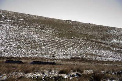
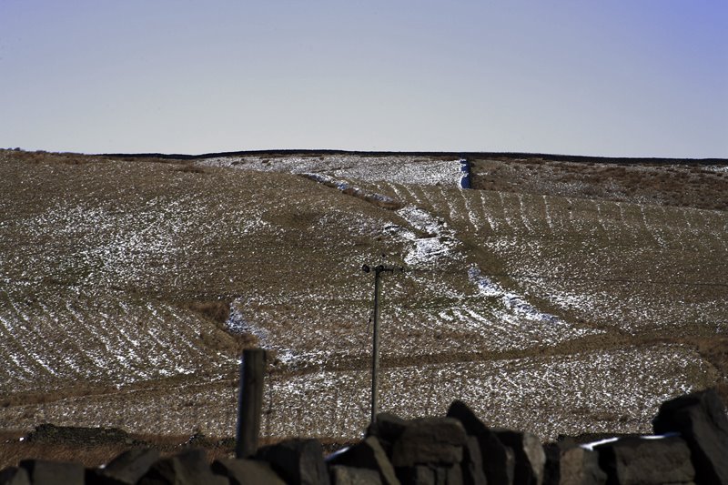 A light dusting of snow over the North Pennine Moors (near Heywood Lancashire UK) revealed extensive marks which look like ridge and furrow. What date they are from is difficult to say and whether they have been ploughed or produced for drainage is also difficult to say. I have looked on Google Earth and several field systems of ridge and furrow are visible crashing into each other at various angles to the south of Tom Hill between Cheesden Pasture and Cheesden Fold. Some respect the current field boundaries and some do not. Below are some pics I took on Saturday.
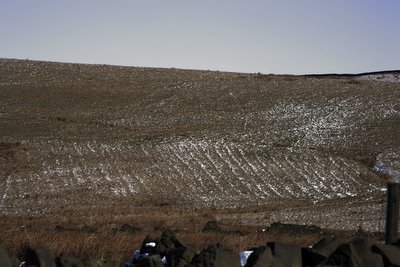
Below is a picture of Tom Hill which is covered in ridge and furrow. Ridge and furrow to the west are cut into by Victorian ventilation shafts showing that they pre-date this period. There is an unusual irregularity as to their positioning and pattern.
All over the area there are derelict farms and barns - the footprints now only survive. It would be fascinating to find out about the history of this area and how the landscape has developed. I'm sure it would add to an area which is poorly documented.
Interestingly, on the Google Earth map there is just visible beneath the pattern of one furrowed field a series of rectangular marks (enclosure?) which possibly predate the ridge and furrows themselves. They lie on the south slope of Tom Hill. I have marked the area on my google earth archi-map (Cheesden Valley) and you can see them for yourself if you download the map here.
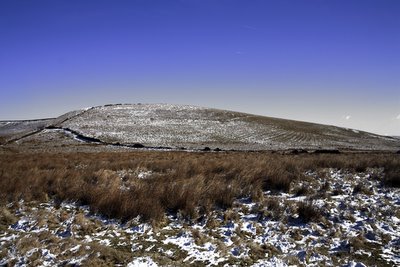
Tom Hill from the South West


No comments:
Post a Comment